Geog at a glance
Area: 55 Sq.Km
Population: 2646 (1329 Male and 1317 Female)
Households: 304 nos.
Local Govt:
| Sl. No. | Designation | Name |
|---|---|---|
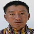
| 1 | Gup | Rinchen Gyelpo |
| 2 | Mangmi | Sangay Duba |
| 3 | Tshogpa (Ngamphoog-Sangkama) | Chenga Wangchuk |
| 4 | Tshogpa (Bilam-Dankila) | Sangay Wangchuk |
| 5 | Tshongpa (Mutangkhar-Tsangkhazor) | Rinchen Tshering |
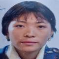
| 6 | Tshogpa (Mutangkhar- Tselam) | Tshering Lhamo |
| 7 | Tshongpa (Kognala-Yaragla) | Sangay Rinchen |
| 8 | Gaydrung | Dorji Wangchuk |
Civil Servants:
| Sl. No. | Designation | Name |
|---|---|---|
| 1 | Geog ADM Officer | Tshering Nidup |
| 2 | Principal (Jurmed PS) | Sangay Tshering |
| 3 | Principal (Yaragla CPS) | Tshering Choephel |
| 5 | Agriculture Extension Officer | Chimi Tshewang |
| 6 | Forestry Extension Officer | Tashi Zangpo |
| 7 | Livestock Extension Officer | Kezang Dorji |
| 8 | Health Assiatant(BHU) | Dorji |
Education:
| Sl. No | Name of School | No. of Teachers | No. of Students |
|---|---|---|---|
| 1 | Jurmed PS | 8 (7 Male & 1 Female) | 217 (95 Boys & 122 Girls) |
| 2 | Yaragla PS | 2 (1 Male & 1 Female) | 21 (8 Boys & 13 Girls) |
| 3 | Sankama ECR | 1 (1 Male & 0 Female) | 13 (6 Boys & 7 Girls) |
Health:
| Sl. No | Deatils | Place |
|---|---|---|
| 1 | Basic Health Unit II | Jurmey |
| 2 | 4 Out of reach Clinic | Sangkama, Muktangkhar, Yaragla and Tsellam |
Lhakhangs:
| Sl. No | Name of Important Lhakhang | Important Relic/Festival | Name of Head Lama | Pvt/Community/Rabday |
|---|---|---|---|---|
| 1 | Ugyen Gatshel Lhakhang | Ugyen Dhisum Khenpa /Annual tshechu-6th day of 9th month of Bhutanese calendar, Kanjur Daksar Chenmo-4th month of Bhutanese calendar | Kinzang Gyeltshen (caretaker) | Community |
| 2 | Bayul Choda Gerwang Lhakhang | Ugyen Pema Jugney | Loday choda (Proprietor) | Pvt |
| 3 | Ngamphu Yeshey Choling Lhakhang | Chugchi Zhey | Lungten tenzin (Proprietor) | Pvt |
Road Connections:
| Sl. No | From | To | High Way | Feeder Road | GC Road | Farm Road> |
|---|---|---|---|---|---|---|
| 1 | Mongar | Zimzorong | 40 Km | |||
| 2 | Zimzorong | Yulderi GC | 23 Km | |||
| 3 | Yulderi | Jurmey GC | 16 Km | |||
| 4 | Yulderi/td> | Sangkama | 6 KM | |||
| 5 | Damzaling | Yakrala | 7.5 KM |
Economic activities:
| Sl. No | Agriculture | Livestock | Other |
|---|---|---|---|
| 1 | -Mandarin and Beans | -7 Poultry farm -3 Piggery farm |
-Hazel Nut Plantation 13.3 acres (5917 tress) -1 Community Forest - Art and Crafts culture |
RNRC: Agriculture, Forestry and Livestock extension services are provided from the Geog centers.
Tele-Communication: 100% coverage by both B-Mobile and T-Cell
Electricity: Not connected (Electrification Work under process)
